
Table of Contents
- Executive Summary: Key Trends and 2025 Snapshot
- Market Size and Forecast: 2025–2030 Projections
- Core Technologies: Sensors, AI, and Imaging Systems
- Key Industry Players and Strategic Partnerships
- Adoption Drivers: Regulatory, Economic, and Environmental Factors
- Emerging Use Cases: From Construction to Environmental Monitoring
- Competitive Landscape: Innovation Leaders and Market Shifts
- Challenges and Barriers to Widespread Adoption
- Future Outlook: Vision Enhancement System Roadmap (2025–2030)
- Official Resources and Further Reading
- Sources & References
Executive Summary: Key Trends and 2025 Snapshot
Surveying drone vision enhancement systems are rapidly transforming the landscape of geospatial data acquisition and analysis. In 2025, the sector is witnessing the convergence of advanced optical sensors, AI-driven data processing, and robust integration with automation platforms. These innovations are enabling drones to perform complex surveying tasks with greater accuracy, efficiency, and in previously inaccessible environments.
One of the most prominent trends in 2025 is the widespread adoption of high-resolution multispectral and hyperspectral imaging cameras. These payloads, provided by companies such as MicaSense and Phase One, allow drones to capture detailed data across multiple wavelengths, supporting nuanced analysis for applications in agriculture, mining, construction, and environmental monitoring. The integration of LiDAR sensors, notably from suppliers like Luminar Technologies and Ouster, is further enhancing the capability of drones to generate precise 3D terrain models, even under dense vegetation or low-light conditions.
Artificial intelligence and machine learning are increasingly embedded within both onboard and cloud-based vision enhancement platforms. DJI and senseFly are leveraging AI for real-time object detection, automated feature extraction, and anomaly recognition, streamlining post-flight data processing and reducing human intervention. Real-time kinematic (RTK) and post-processed kinematic (PPK) technologies, as found in advanced platforms from Trimble, are improving geolocation accuracy to the centimeter level, which is critical for survey-grade mapping.
Regulatory shifts in 2025 are also shaping the outlook for vision enhancement systems. The implementation of new standards by authorities such as the Federal Aviation Administration (FAA) for BVLOS (Beyond Visual Line of Sight) operations is expanding the operational envelope of surveying drones, driving demand for advanced vision-based navigation, collision avoidance, and redundancy systems.
Looking ahead, the next few years are expected to bring further miniaturization of high-performance sensors, broader integration of AI analytics, and seamless interoperability with GIS and CAD platforms. Industry leaders are investing in scalable cloud services for data storage and analysis, as seen with Pix4D and Esri, enabling end-to-end automation from data capture to actionable insights. Overall, the evolution of surveying drone vision enhancement systems is set to drive significant productivity gains and open new frontiers across infrastructure, natural resources, and urban planning sectors.
Market Size and Forecast: 2025–2030 Projections
The market for surveying drone vision enhancement systems is on a robust growth trajectory, driven by the increasing adoption of drones across multiple industries such as construction, agriculture, mining, and infrastructure inspection. As of 2025, rapid advancements in imaging technologies—particularly in thermal, multispectral, and LiDAR sensors—are expanding the capabilities and use cases for commercial and industrial drone applications.
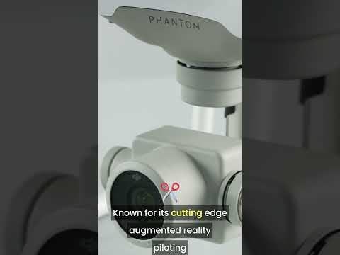
Manufacturers like DJI and Parrot have introduced drones equipped with sophisticated vision enhancement payloads, such as high-resolution RGB cameras, thermal imagers, and advanced AI-based processing modules. For instance, DJI’s Matrice series supports modular vision enhancement systems, enabling precise mapping and real-time analytics that were previously unattainable with conventional aerial survey tools.
In 2025, the global surveying drone vision enhancement market is estimated to surpass several billion dollars in annual revenue, with double-digit compound annual growth rates projected through 2030. The surge is attributed to regulatory support for drone integration, cost reductions in sensor manufacturing, and increased demand for geospatial intelligence. Key industry bodies such as the Association for Uncrewed Vehicle Systems International (AUVSI) emphasize the growing reliance on enhanced vision technologies to enable safer, more efficient automated flight operations in complex environments.
The next five years are expected to see continued innovation in computer vision, edge processing, and sensor miniaturization. Companies like FLIR Systems (now part of Teledyne) are advancing compact thermal imaging modules specifically for UAVs, providing critical capabilities for night operations and low-visibility surveying. Similarly, senseFly is integrating multispectral and photogrammetric payloads to deliver high-precision agricultural and topographical mapping solutions.
Looking ahead to 2030, the market outlook remains strongly positive. The proliferation of AI-powered analytics, seamless cloud integration, and the emergence of fully autonomous surveying drones are anticipated to further bolster demand for vision enhancement systems. Strategic partnerships between drone manufacturers and sensor specialists will likely intensify, as end-users seek turnkey solutions for increasingly complex surveying challenges. Overall, the sector is poised for sustained expansion, with vision enhancement technologies at the forefront of innovation in aerial surveying applications.
Core Technologies: Sensors, AI, and Imaging Systems
Surveying drone vision enhancement systems have advanced rapidly, driven by the integration of cutting-edge sensors, artificial intelligence (AI), and imaging technologies. As of 2025, the majority of professional surveying drones leverage high-resolution CMOS and CCD cameras, often exceeding 40 megapixels, to capture detailed imagery crucial for applications such as topographical mapping, construction monitoring, and infrastructure inspection. Manufacturers such as DJI and senseFly are at the forefront, offering drones equipped with interchangeable payloads that include RGB, multispectral, and thermal cameras for enhanced data collection.
Sensor fusion is a key trend, combining data from multiple sources—visual, LiDAR, and thermal sensors—to produce richer and more reliable outputs. For example, Hexagon integrates LiDAR scanners with photogrammetric cameras to deliver highly accurate 3D models and point clouds, which are essential for land surveying and urban planning. The adoption of real-time kinematic (RTK) and post-processed kinematic (PPK) GNSS modules further refines georeferencing accuracy, reducing errors to the centimeter level in complex environments.
AI and machine learning are increasingly embedded within vision enhancement systems to automate image analysis and feature extraction. Parrot and Foxtech have incorporated onboard AI processors that can classify objects, identify anomalies, or flag changes between survey intervals in real time. This automation is drastically reducing labor hours traditionally required for post-processing and interpretation, paving the way for near-instantaneous insights in the field.
Thermal and multispectral imaging continue to gain traction, especially in environmental monitoring, precision agriculture, and disaster response. Teledyne FLIR specializes in compact thermal cameras that can be seamlessly integrated into surveying drones, enabling users to detect heat signatures, moisture levels, and vegetation health. Multispectral sensors from companies like MicaSense support detailed analysis of plant vitality and soil conditions.
Looking ahead, the next few years are expected to bring even greater sensor miniaturization, improved onboard AI capabilities, and seamless cloud connectivity for real-time data streaming and collaborative analysis. Industry leaders are investing in developing open interfaces for payload integration, allowing surveyors to customize their drones for specific missions. With regulatory frameworks evolving to support beyond visual line of sight (BVLOS) operations, the adoption of advanced vision enhancement systems is poised to accelerate, making drone-based surveying more efficient, accurate, and versatile than ever before.
Key Industry Players and Strategic Partnerships
The surveying drone vision enhancement systems sector is witnessing rapid growth and strategic realignment as both established drone manufacturers and specialized component suppliers intensify their focus on advanced imaging, data processing, and AI-driven analytics. As of 2025, several key industry players are shaping the landscape through innovation, partnerships, and targeted acquisitions.
- DJI remains a dominant force, continuously upgrading its surveying drone lineup with next-generation vision enhancement tools. Their latest Matrice series integrates enhanced thermal, multispectral, and LiDAR sensors, boosting accuracy and versatility for industrial surveying applications. The company is also collaborating with industry-specific partners to develop tailored solutions for construction, agriculture, and mining (DJI).
- Parrot has consolidated its position in the professional surveying market by expanding partnerships with sensor manufacturers and software developers, such as integrating multispectral cameras and AI-based image processing for precise agricultural mapping. Their ANAFI platform now offers modular payloads, including high-resolution RGB and thermal cameras designed in conjunction with leading optics firms (Parrot).
- Teledyne FLIR is advancing vision enhancement capabilities through its state-of-the-art thermal and hyperspectral imaging payloads, which are now featured in multiple surveying drone platforms. The company has recently entered into joint development agreements with UAV manufacturers to deliver seamlessly integrated sensor solutions, with a focus on infrastructure inspection and environmental monitoring (Teledyne FLIR).
- Trimble continues to be a pivotal player, leveraging its expertise in geospatial technologies and vision enhancement to create end-to-end surveying drone solutions. Strategic collaborations with GNSS and photogrammetry specialists are enabling real-time data fusion, while recent partnerships with AI analytics startups are focused on automating feature extraction and anomaly detection (Trimble).
- Quantum Systems is gaining traction by integrating AI-driven vision enhancement systems in its fixed-wing drones. In 2025, the company announced a partnership with leading European sensor providers to develop lightweight, high-fidelity imaging modules optimized for large-scale mapping and corridor surveys (Quantum Systems).
Looking forward, the next few years are expected to bring deeper collaboration across the hardware, optics, and analytics ecosystem. The convergence of high-performance sensors, edge computing, and cloud-based processing—often via strategic alliances—will accelerate the deployment of intelligent vision enhancement systems, enabling drones to deliver even richer, more actionable geospatial data across surveying domains.
Adoption Drivers: Regulatory, Economic, and Environmental Factors
The adoption of advanced vision enhancement systems in surveying drones is being driven by a convergence of regulatory, economic, and environmental factors in 2025 and beyond. Regulatory authorities worldwide are progressively updating frameworks to not only allow, but also incentivize the use of sophisticated sensor technologies in unmanned aerial vehicles (UAVs) for surveying applications. For example, the United States Federal Aviation Administration (FAA) continues to expand waivers for beyond visual line of sight (BVLOS) operations, contingent on the deployment of robust detect-and-avoid and vision enhancement systems in drones, thus accelerating uptake among commercial surveyors (Federal Aviation Administration).
Economically, the declining cost of high-performance imaging payloads—such as LiDAR, multispectral, and thermal cameras—has made it feasible for a broader spectrum of organizations to deploy drones for surveying. Major drone manufacturers are integrating advanced vision enhancement solutions like obstacle avoidance, real-time kinematic (RTK) positioning, and AI-powered image processing to deliver greater accuracy and productivity. For instance, DJI and senseFly are offering drones equipped with sophisticated vision systems specifically engineered for mapping, construction, and environmental monitoring.
Environmental considerations are also propelling the demand for improved vision systems in drone-based surveying. As regulatory requirements for environmental impact assessments tighten, industries such as mining, agriculture, and energy are turning to UAVs with advanced imaging capabilities to minimize ecological disturbance and ensure compliance. Enhanced vision systems enable drones to operate in diverse conditions—such as low light, fog, or dense vegetation—facilitating more accurate and comprehensive data collection while reducing the need for repeated flights and lowering carbon footprint. Companies like Teledyne FLIR and Parrot are at the forefront, supplying thermal and multispectral payloads that are crucial for applications ranging from wildlife monitoring to infrastructure inspection.
Looking forward, the outlook for adoption is strong as regulatory acceptance grows, technology costs decline, and environmental pressures mount. Cross-industry collaborations and the continued evolution of artificial intelligence and machine learning for onboard sensor data processing are expected to further accelerate the deployment of advanced vision enhancement systems in surveying drones through the latter half of this decade.
Emerging Use Cases: From Construction to Environmental Monitoring
Surveying drone vision enhancement systems are at the forefront of transforming a broad spectrum of industries, with 2025 marking a pivotal year for their adoption and innovation. Enhanced vision capabilities—leveraging high-resolution RGB cameras, multispectral and thermal sensors, as well as AI-powered analytics—are extending the reach of drones from traditional mapping into highly specialized applications.
- Construction and Infrastructure: Construction sites have become primary beneficiaries of enhanced drone vision. In 2025, leading manufacturers such as DJI and Parrot are deploying drones equipped with real-time kinematic (RTK) GPS, 4K/8K video, and LiDAR sensors to provide centimeter-level accuracy in surveying and volumetric analysis. These systems enable rapid progress monitoring, structural inspections, and safety audits, reducing manual surveying time by up to 60%. AI-driven defect detection and BIM (Building Information Modeling) integration are increasingly standard, streamlining workflows and documentation.
- Mining and Quarrying: Enhanced vision systems are accelerating ore estimation, pit mapping, and slope stability analysis. Companies like senseFly (a Parrot company) supply drones with advanced photogrammetry and multispectral imaging, supporting autonomous data capture even in hazardous environments.
- Environmental Monitoring and Forestry: Multispectral and thermal imaging payloads are revolutionizing ecosystem surveys, biodiversity monitoring, and wildfire assessment. Teledyne FLIR provides thermal sensors that, when mounted on drones, allow early detection of forest fires, wildlife tracking, and even tree health assessments. Drones are now integral to carbon stock estimation and habitat mapping, with AI-classification of land cover types enhancing precision and speed.
- Utilities and Energy Sectors: Vision enhancement systems are used for powerline inspections, solar farm surveys, and wind turbine monitoring. DJI Enterprise and senseFly offer solutions that combine zoom cameras, radiometric thermal imaging, and automated flight paths, allowing utilities to detect faults before they escalate, reducing downtime and operational risk.
Looking forward, the integration of AI and machine learning with drone vision systems is expected to further automate image analysis, anomaly detection, and predictive maintenance. Cloud-based geospatial platforms from companies like Pix4D are making real-time data sharing and collaboration possible, accelerating decision-making across sectors. Regulatory advances and growing interoperability with IoT infrastructure will likely result in even broader adoption through 2025 and beyond, positioning surveying drone vision enhancement systems as essential tools in both public and private sector initiatives.
Competitive Landscape: Innovation Leaders and Market Shifts
The competitive landscape for surveying drone vision enhancement systems in 2025 is marked by rapid technological innovation and increasing market participation by both established aerospace corporations and agile start-ups. Vision enhancement—encompassing multispectral, thermal, LiDAR, and AI-powered imaging—has become central to the value proposition of professional surveying drones, driving differentiation and reshaping market dynamics.
A notable leader, DJI, continues to dominate with its Matrice series, offering integrated vision systems that combine high-resolution RGB cameras with modular thermal and multispectral sensors. In 2024 and 2025, DJI expanded collaborations with payload specialists, enabling plug-and-play compatibility for advanced sensors, and introduced enhanced real-time AI-based image analysis for faster decision-making in the field.
Meanwhile, senseFly, now part of the AgEagle family, has bolstered its eBee X platform with partnerships for superior multispectral payloads, targeting precision agriculture and land management sectors. These payloads are supported by improved GNSS integration and onboard data processing, reducing the need for post-flight computation and expediting survey workflows.
In the LiDAR segment, Hexagon and its subsidiary Leica Geosystems are recognized for pushing the envelope with lightweight, high-density LiDAR sensors tailored for UAVs. Their 2025 product releases focus on increasing point cloud density and accuracy while optimizing power consumption for extended drone operations.
Start-ups and niche players are driving innovation in AI-powered vision analytics. Companies like Skydio have introduced drones with onboard neural networks, enabling real-time feature recognition, obstacle avoidance, and autonomous data collection. Skydio’s recent platform advances allow for seamless integration with third-party surveying software, enhancing workflow automation.
Looking forward, the competitive intensity is likely to increase as vision hardware costs decline and AI-enhanced processing becomes standard. Key trends include:
- Greater interoperability between UAV hardware and specialized vision payloads, facilitated by open standards and modular architectures.
- Expansion of cloud-based data analytics platforms, such as those from Trimble, offering instant post-flight processing and collaborative tools for survey teams.
- Entry of new players leveraging edge AI and quantum sensor technologies, promising breakthroughs in low-light and adverse weather imaging.
Overall, 2025 and the following years will see intensified competition, with innovation cycles increasingly driven by end-user demand for accuracy, real-time insights, and workflow efficiency in drone-based surveying vision systems.
Challenges and Barriers to Widespread Adoption
Despite rapid technological advances, several challenges continue to constrain the widespread adoption of vision enhancement systems in surveying drones as of 2025 and into the near future. Key among these are regulatory barriers, integration complexities, cost constraints, and limitations in sensor performance under diverse field conditions.
Regulatory Hurdles: Stringent aviation regulations regarding the use of enhanced vision technologies, especially those involving beyond visual line of sight (BVLOS) operations, remain a significant barrier. Requirements set by authorities such as the Federal Aviation Administration (FAA) for special waivers, pilot certifications, and airspace restrictions limit the deployment of drones equipped with advanced vision enhancement modules in many regions. Regulatory harmonization and streamlined approval processes are anticipated but have not yet materialized on a global scale, as reflected in updates from Federal Aviation Administration.
Integration and Interoperability: Surveying environments demand robust integration of vision enhancement systems—such as multispectral or thermal imaging—with existing drone navigation, mapping, and data processing platforms. Manufacturers face technical hurdles in ensuring seamless interoperability across hardware and software ecosystems. For example, implementing real-time data fusion from multiple sensor modalities without compromising flight endurance or system reliability is an ongoing engineering challenge, as outlined by DJI in their enterprise solutions documentation.
Cost and Scalability: The incorporation of high-performance vision enhancement modules, including advanced LiDAR, thermal, or hyperspectral cameras, raises the overall system cost. This limits accessibility for smaller surveying firms and emerging markets. While component prices are declining due to economies of scale, upfront investment and ongoing maintenance costs remain significant hurdles for widespread adoption, as acknowledged by senseFly, a Parrot company.
Environmental and Operational Constraints: Sensor performance can degrade under adverse weather, extreme lighting, or highly reflective surfaces—common in many field survey scenarios. Enhancements such as anti-fog coatings, AI-driven image correction, and ruggedized hardware are being developed, but are not yet universally reliable or standard across all platforms. Teledyne FLIR highlights the ongoing need for algorithmic and hardware improvements to ensure consistent vision enhancement in demanding environments.
Looking ahead, overcoming these challenges will require coordinated progress in regulatory frameworks, system integration standards, cost reduction strategies, and sensor innovation. Industry partnerships and ongoing dialogue with regulatory bodies are expected to play a key role in accelerating adoption over the next few years.
Future Outlook: Vision Enhancement System Roadmap (2025–2030)
Looking ahead from 2025, the roadmap for vision enhancement systems in surveying drones reveals rapid innovation and expanding applications. The integration of advanced sensor fusion, artificial intelligence (AI), and real-time processing is expected to define the next generation of aerial survey platforms. The trend is already visible among industry leaders who are developing and deploying multi-modal vision systems that combine high-resolution optical cameras with thermal, multispectral, and LiDAR sensors.
In 2025, manufacturers such as DJI and senseFly (a Parrot company) are advancing embedded AI on drones, enabling real-time object recognition, terrain mapping, and adaptive flight paths based on live environmental inputs. These systems are designed for robust performance in challenging weather and lighting conditions, with sensors that dynamically adjust parameters for optimal data capture.
A key focus from 2025 onwards is autonomous decision-making. Companies like Teledyne FLIR are integrating thermal imaging with AI-driven analytics, allowing drones to identify survey targets or hazards automatically, reducing operator workload and increasing mission safety. The convergence of AI and edge computing is set to accelerate, with onboard processors handling complex vision tasks without relying on cloud connectivity, a critical requirement for remote or bandwidth-limited sites.
Hardware improvements are also on the horizon. Sensor miniaturization and power efficiency are priorities, with Leica Geosystems and Ricoh investing in lighter, longer-range LiDAR and hyperspectral modules. These advancements will allow drones to perform longer missions and cover larger areas with higher data fidelity, all while maintaining compliance with evolving regulatory and safety standards.
Looking out to 2030, the vision enhancement systems market is expected to see increased standardization and interoperability, with manufacturers such as Trimble focusing on open architectures and integration with Geographic Information Systems (GIS) and Building Information Modeling (BIM) platforms. Real-time, cloud-synced analytics and collaborative data sharing between fleets of drones are forecasted, enabling large-scale, cooperative mapping and inspection projects.
With continued investment in R&D and cross-sector partnerships, the 2025–2030 period will likely witness surveying drones becoming indispensable tools for industries ranging from construction and agriculture to disaster response, underpinned by ever-more capable and intelligent vision enhancement systems.
Official Resources and Further Reading
As the field of surveying drone vision enhancement systems continues to evolve rapidly, numerous official resources from leading manufacturers, suppliers, and industry organizations provide valuable insights, technical documentation, and updates on current and emerging technologies. Below is a curated selection of authoritative resources and further reading for 2025 and beyond:
- DJI – Explore technical specifications, white papers, and case studies for the latest enterprise surveying drones and integrated vision enhancement systems, including multispectral and LiDAR payloads.
- Parrot – Access detailed documentation and insights on advanced imaging, AI-driven analytics, and vision system integration for commercial surveying and mapping applications.
- senseFly – Review resources on fixed-wing drone vision solutions, including software guides for enhanced photogrammetry and 3D mapping workflows.
- Teledyne FLIR – Find comprehensive information on thermal imaging and visible-light camera systems designed to enhance drone vision for precision surveying, infrastructure monitoring, and environmental assessment.
- Leica Geosystems – Examine technical manuals, webinars, and product updates on high-precision vision enhancement modules and integrated sensor solutions for aerial surveying.
- RIEGL – Access application notes and user guides for LiDAR-based vision enhancement systems tailored for UAV-based land surveying and topographic mapping.
- Autel Robotics – Explore product pages and technical support for drones equipped with advanced imaging payloads and AI-assisted vision modules for surveying professionals.
- Association for Uncrewed Vehicle Systems International (AUVSI) – Stay updated with industry standards, regulatory guidance, and best practices impacting drone vision technologies for surveying.
- UAV Systems Association (UAVSA) – Access industry resources, technical papers, and regulatory updates relevant to drone-based vision enhancement in surveying.
These resources offer a blend of technical knowledge, regulatory information, and industry perspectives to support further exploration and adoption of advanced vision enhancement systems in surveying drones through 2025 and the years ahead.
Sources & References
- MicaSense
- Phase One
- Luminar Technologies
- Ouster
- senseFly
- Trimble
- Pix4D
- Esri
- Parrot
- Association for Uncrewed Vehicle Systems International (AUVSI)
- Hexagon
- Skydio
- Ricoh